
Blackhouse Hill
This analysis was undertaken for a proposed housing scheme on Kent, which was intended to be built into a steep existing hillside, which clearly had been afffected by previous ground movement. The scheme is shown in some detail as it clearly shows the necessary symbiosis required between the stuctural and geotechnical engineering aspects of the scheme.
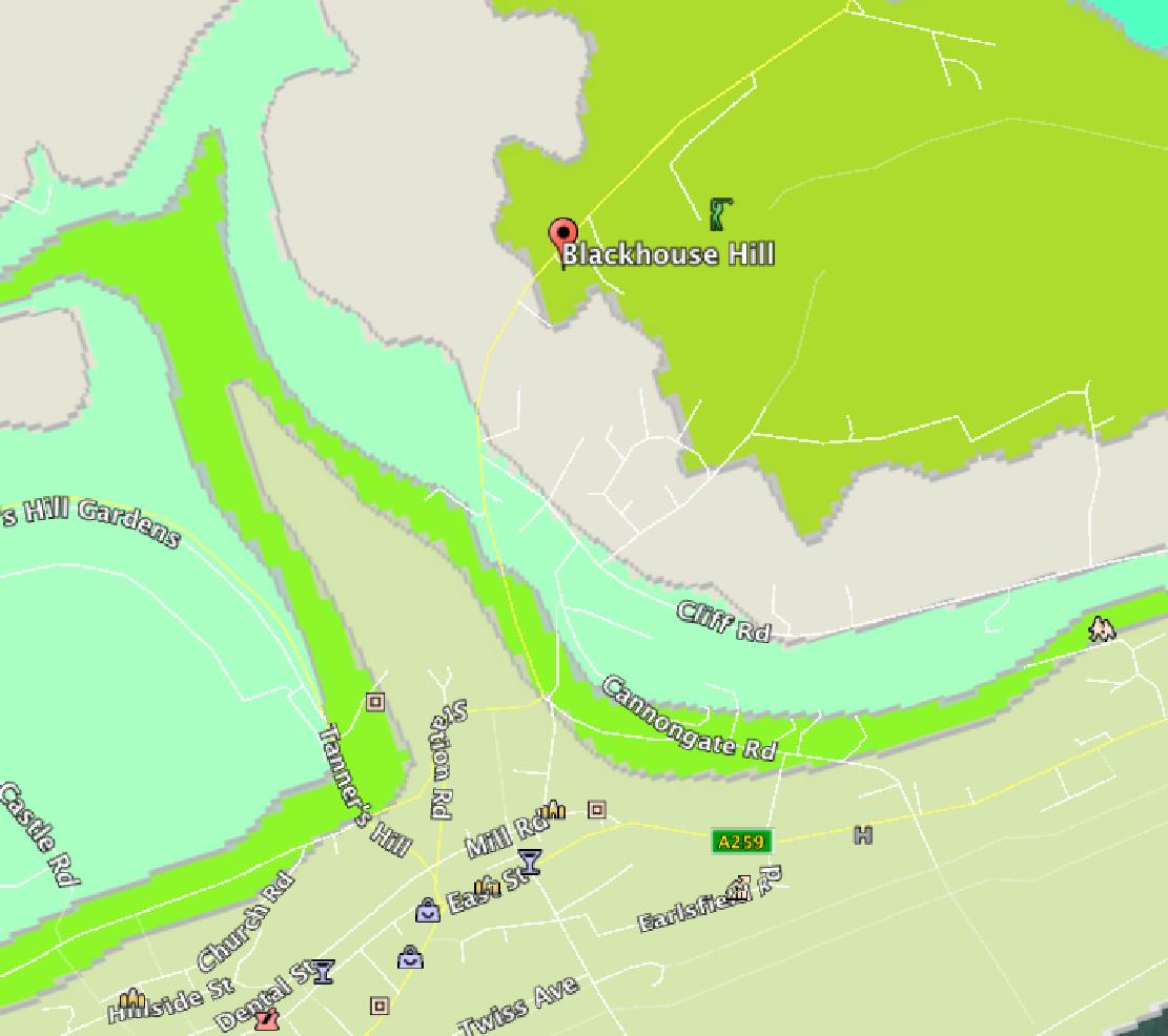
First the geological map of the area is consulted and all available boreholes records examined. At this stage all available past maps of the area are consulted to see if there is any significant past usage or changes on the site.

The Lidar data for the area is then consulted and a contoured plan and section
created.
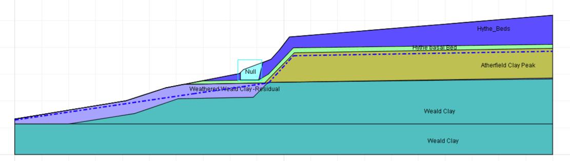
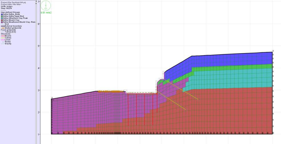
The section is then combined with the site survey and boreholes taken out on site to produce a site model showing levels, ground strata and condition, water table etc.
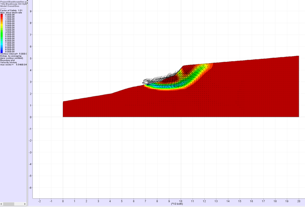
In this case it was clear that slips had occurred on the site at some time but were currently stable so the properties of the ground and level of the water table were adjusted, within reasonable limits, to give a factor of safety of one. The FOS plot is shown above. A contour plot was then made of the fos.
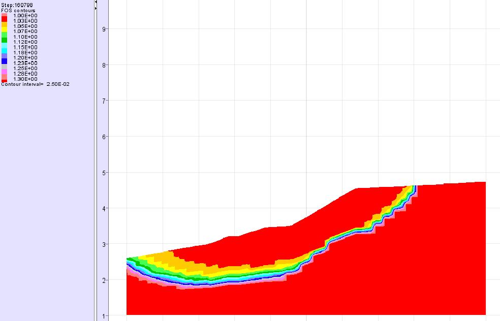
The above plot shows the areas where the fos varies from 1, the upper red area, to 1.25, the blue area. This gives reasonable limits to the disturbed ground and the likely depth to which the ground may be affected by the proposed development.he model was run with the proposed excavation and with the excavation only lined with concrete to mimic retaining walls and shallow foundations.

The revised fos was 0.51. The water table was then reduced to below the proposed excavation and the analysis run again. It was found that the fos then becomes 1.10 i.e. better than existing with a high water table.
So it was clear that the way to deal with overall stability was by drainage but the local stability of the foundations and retaining walls still had to be addressed.
A number of alternative proposals were investigated and it was found that a combination of piles to the houses tied to a substantial foundation raft together with a piled main retaining wall and two sets of soil nails, as well as the drainage had the effect of increasing substantially the fos against sliding whilst keeping the calculated deflections within sensible limits.
The proposed model is shown above.
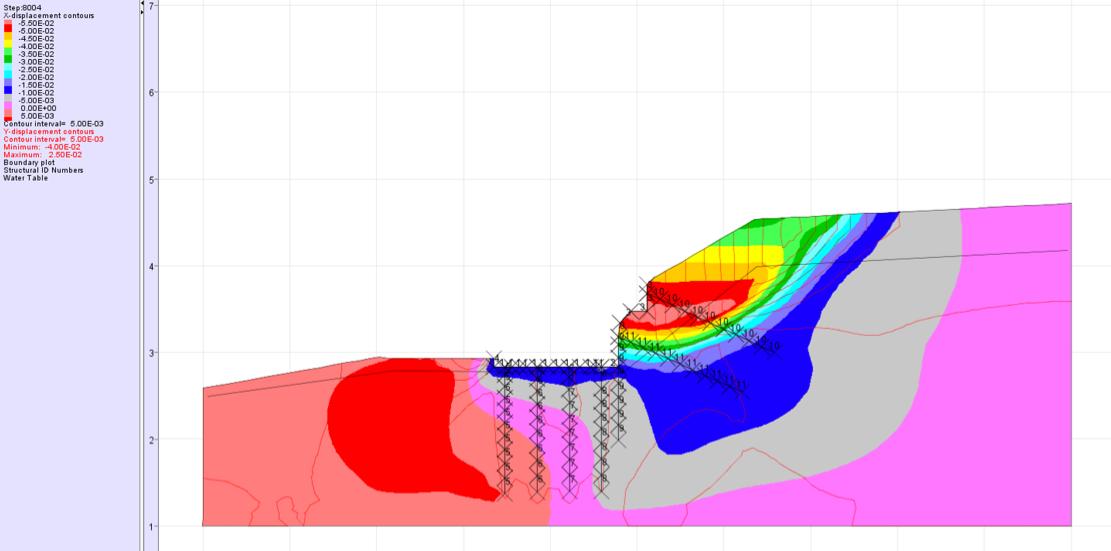
The above model shows the displacements within the structure once the model is brought to equilibrium i.e. a maximum of 55mm on the upper retaining wall and 10-15mm horizontally at the house position.

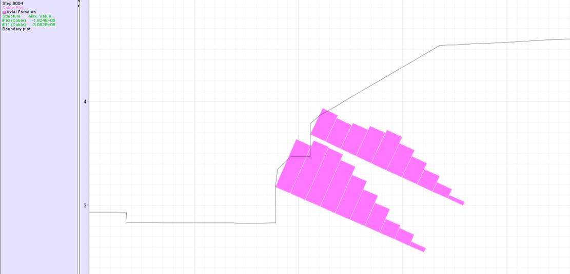
This plot shows the moments in the walls and piles. The one below shows the forces in the soil nails.
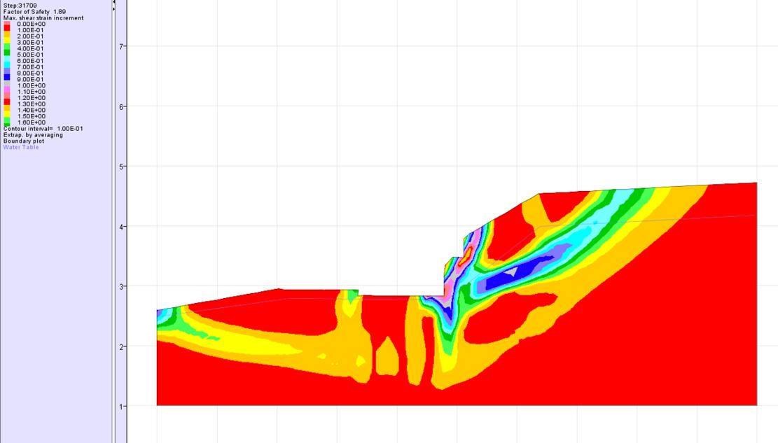

Finally the fos taking into account the proposed structure becomes 1.89. The slip being forced down around the main retaining wall piles. Hence the design has increased the factor of safety by nearly 90%. However, it is still necessary to design each stage of the work separately and prepare a detailed method statement that the contractor has to adhere to to ensure that stability is maintained throughout the construction process. The final foundation model is shown in relation to the existing ground in the middle sketch and from above in the final sketch. Note that the results for only one section are shown. In reality the whole exercise was reported for three different sections on this site.